
One screen for the flat
Tide, wind, water temp and light for your flat, assembled once from real instruments. Built on the web app in about ten minutes.
- Step 1 · The problem
Step 1 of 7. Permit fishing is four numbers at once
Tide height on the flat. Wind against the pole. Water temperature the fish will actually eat in. Light you can see them in.
Any one of them is a browser tab. All four at once, for your flat, every morning — that is what an Environment is for.
→NextIt starts on the Environments page.About 10 minutes to buildOne screen, four answers
Tide, wind, water temp and the flood calendar for your flat — assembled once, read every morning in ten seconds.
- Step 2 · Step one
Step 2 of 7. New Environment
Environments live under the Environments tab on the web app — building a board is a web job, with a keyboard and a big screen. The boards you build there read fine on the phone.
Hit New Environment and the wizard walks you through the rest of this guide.
→NextFirst it asks what this board is for.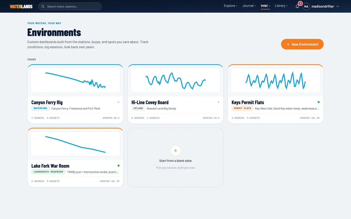
- Step 3 · Name & tag
Step 3 of 7. Call it what it is, tag it Permit
Name the board the way you say it out loud — "Keys Permit Flats" beats "Environment 3" forever.
The activity tag matters more than it looks: picking Permit · Flats tells the widget palette to lead with the saltwater flats kit, so the right parts are on top when you get to the build step.
→NextThen you point it at real instruments.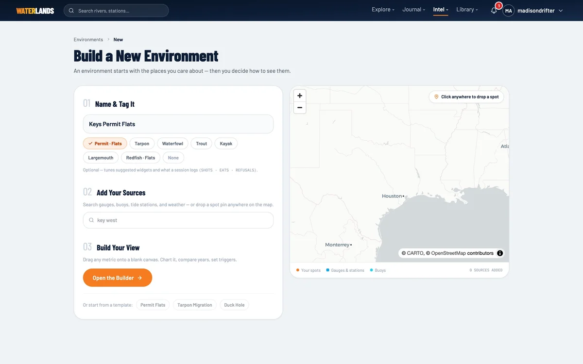
- 1Permit · Flats — this tag sorts the widget palette for you
- Step 4 · Sources
Step 4 of 7. Tide station, buoy, weather point
A source is an instrument the board reads. For the Lower Keys: the Key West NOAA tide station for water level, the Sand Key buoy for water temp and wind measured over water, a weather point on your flat for the forecast, and the flat itself as a Spot.
When you attach a source, Waterlands probes it and shows exactly which readings it actually serves. A widget can only bind to a reading the probe confirmed — the board cannot claim data that does not exist.
Tide station (NOAA)Buoy (NDBC)Weather pointYour SpotTipPrefer the buoy for wind and water temp when you have one — it is an anemometer over the water you fish, not a forecast for the airport.→NextNow the fun part.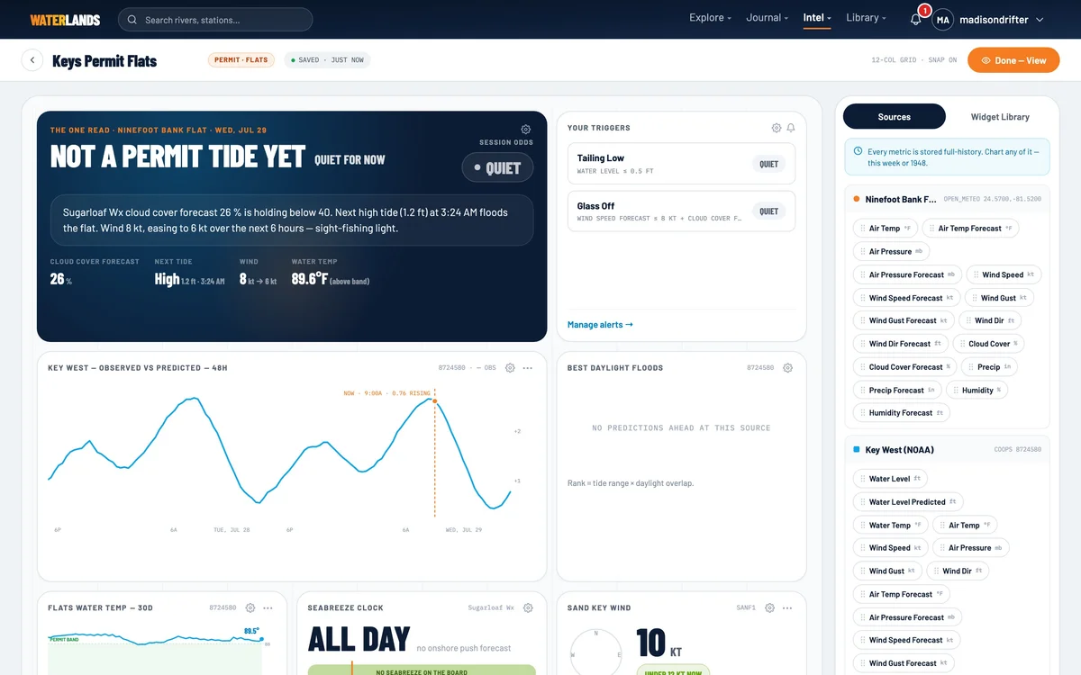
- Step 5 · Widgets
Step 5 of 7. Drag the flats kit onto the grid
The palette holds every widget, led by the flats kit your tag picked. Tide Curve is the anchor — observed against predicted with night shading. Flood Rank scores the next two weeks of tides by range and daylight. Seabreeze Clock calls the hour the glass dies.
Drag them on, drag them around, size them how you read them. It is your board; there is no correct layout.
Tide CurveFlood RankSeabreeze ClockWind Now + ForecastWater Temp BandWeather Board→NextTwo widgets earn a minute of tuning.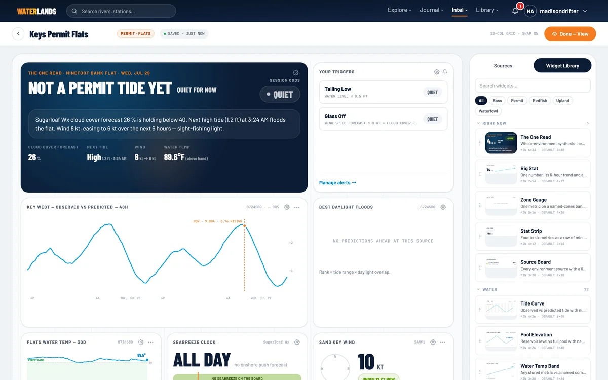
- 1The palette — flats widgets first, because of the tag
- Step 6 · Thresholds
Step 6 of 7. Teach it your flat’s numbers
The Water Temp Band takes a named band — set it to the range your flat actually eats in and the chart carries a permit band label instead of a bare line. The Wind widget takes a comfort limit; set it to what you can pole against, and the forecast bars grade themselves against your number.
This is the difference between a dashboard and your dashboard. The widgets hold your thresholds, so reading the board takes seconds instead of judgment.
→NextThen let it call you instead.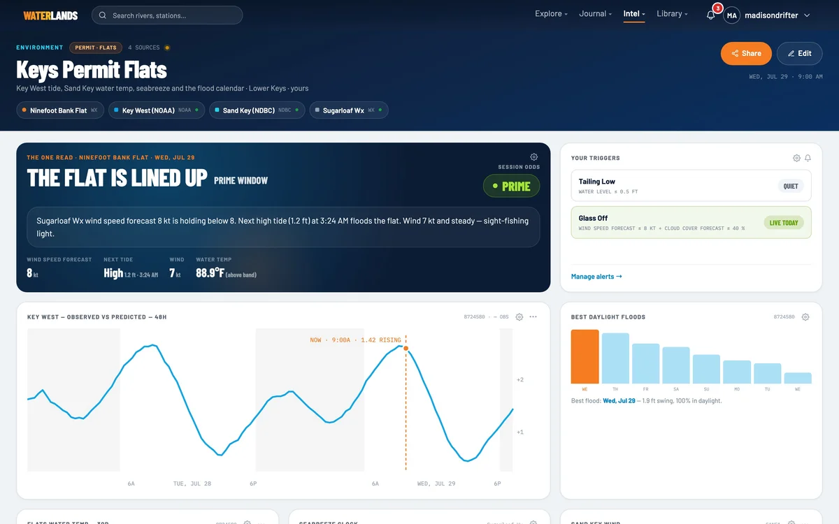
- 1The permit band — your numbers, not ours
- Step 7 · The trigger
Step 7 of 7. “Tell me when it goes glass”
Triggers watch the board's own sources. A threshold trigger fires on one line — water level under half a foot. A combo fires when several hold at once: wind forecast under eight knots and cloud under forty percent is a sight-fishing morning, and you can know the night before.
Build the board once, set the trigger once, and the flat calls you.
Set it and forget itAlso on this board
Moon & Solunar, the Weather Board, a pin map of your flats, and the trigger stack showing which gates are currently green.